
Iceland Volcano: Eruption Continues To Be Likely -- Iceland Met Office
Categories
Edited | All Content | Disasters | Earthquakes | Volcanos | Government | Science | Europe | Atlantic Ocean | News | News -- WNT Selected
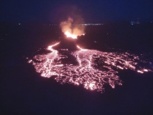
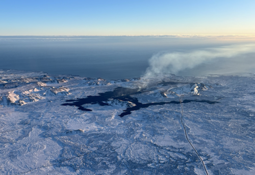 Lava from the eruption 8 February 2024. Photo: Birgir Vilhelm Óskarsson/The Icelandic Institute of Natural History.
Less certainty on the timing of the next dike intrusion and possible eruption
Information is updated regularly here and on X Formerly known as Twitter).
Updated 15 March at 14:30 UTC
Likely sequence of events in the next few days:
- The amount of magma under Svartsengi continues to increase, which could end with a new magma intrusion and possibly an eruption.
- An eruption could start with very little warning, possibly within 30 minutes.
- It is most likely that an eruption would occur in the area between Stóra-Skógfell and Hagafell.
Main changes in activity:
- There are indications that more magma needs to accumulate under Svartsengi than before, to trigger a new dike intrusion and possibly an eruption.
- There is now higher uncertainty than before about the timing of the next dike intrusion and possible eruption.
Note:
- When the weather worsens, the sensitivity of the Icelandic Meteorological Office's monitoring system decreases. Today and this evening, there is strong wind and precipitation in Reykjanes Peninsula. Therefore, it can be assumed that both the sensitivity of the earthquake and the real-time GPS monitoring of the Meteorological Office will be impaired. The weather will also affect tremor detection and visual monitoring with webcams. The weather will rapidly improve by midnight today 15 March.
Higher uncertainty than before about the timing of the next dike intrusion and possible eruption.
GNSS displacements and recent interferograms show continued inflation of the Svartsengi magma reservoir – at a similar rate to that observed before the diking event on 2 March 2024. Geodetic modeling using these datasets confirms the inflation source is also at a similar location and depth as that observed during previous inflation episodes.
The models indicate a recharge volume of approximately 4 million cubic meters to the Svartsengi reservoir since 3 March.
For the diking events from 14 January to 2 March, the failure limit calculated to trigger these dike intrusions and/or eruptions was consistently estimated at around 10 million cubic meters. This enabled longer-term forecasts based on the volume loss from the magma reservoir during the diking events and then estimating the time window when this amount would be fully recharged, triggering the next event.
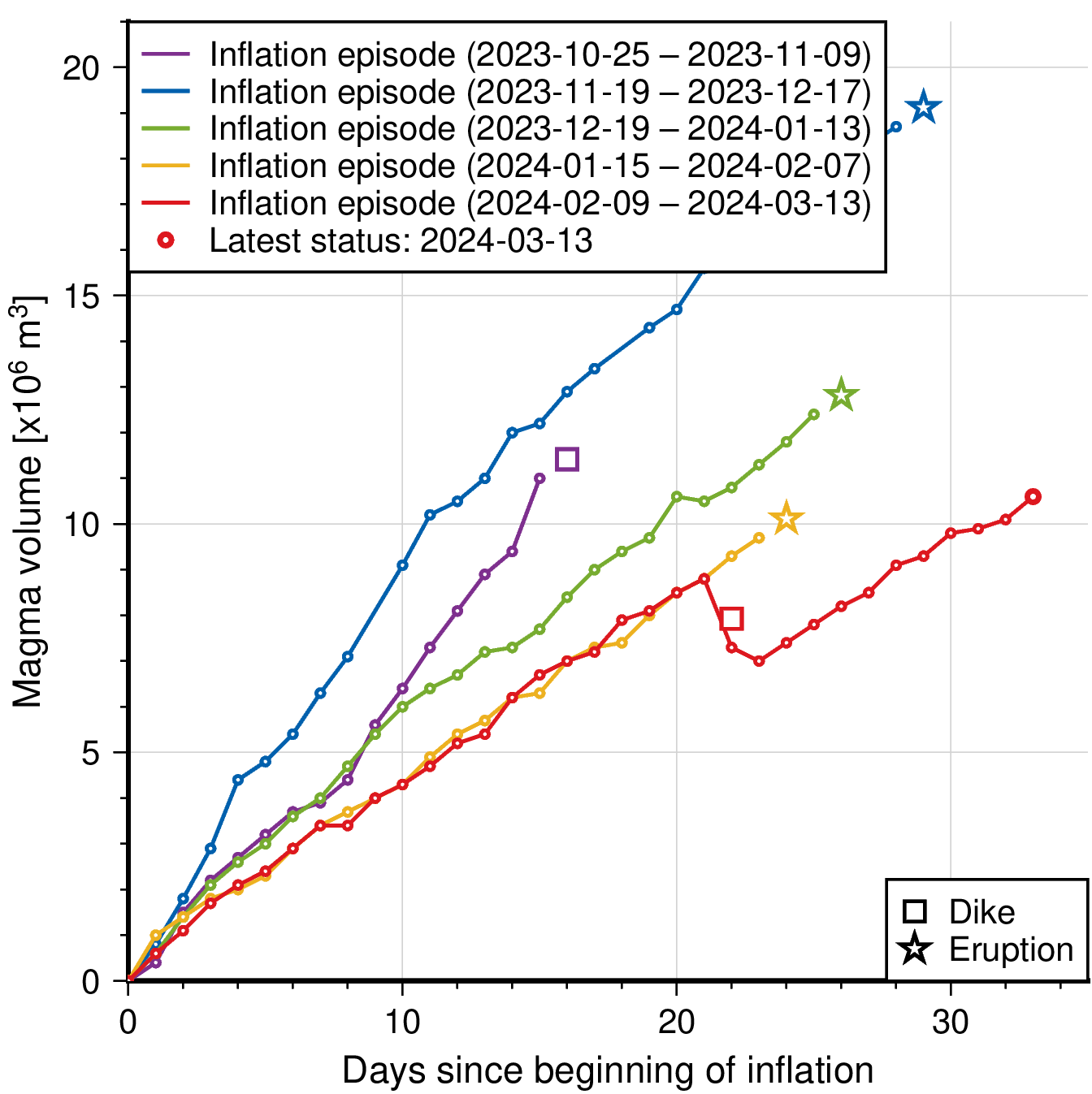
However, on 2 March it is estimated that a much smaller volume was lost from the magma reservoir during this event (approx. 1.3 million m3) which triggered a small dike intrusion that did not result in an eruption.
A larger volume, compared with the amount lost from the Svartsengi reservoir on 2 March, has now been recharged, yet a new dike intrusion/eruption has not yet occurred. This indicates a possible change in the magma plumbing system and greater uncertainty in the new failure limit that now needs to be reached, and thus the timing, of the next dike intrusion and/or eruption.
When this new limit is reached, the most likely scenario is another dike intrusion within the existing diking area – between Stóra-Skogfell to Grindavík – which may or may not culminate in an eruption.
Seismicity NW of Grindavík not a sign of dike intrusion there
We cannot rule out the possibility of an eruption occurring within an adjacent area or volcanic system -- for example, west of Mt Þorbjörn or in Eldvörp -- however, before this occurs a new dike will first need to be intruded in the corresponding area.
There is no evidence of a dike intrusion within these areas. Such an intrusion in a new area is expected to be characterized by a strong earthquake sequence and large amounts of ground deformation detected on both the GNSS network and interferograms. None of these monitoring datasets show any evidence of this.
There has been an increase in seismicity (all earthquakes < M1.5) to the northwest of Grindavík. It is likely that the continued inflation of the Svartsengi magma reservoir is now triggering small movements on pre-existing faults in this area that were activated during the 10 November 2023 diking event.
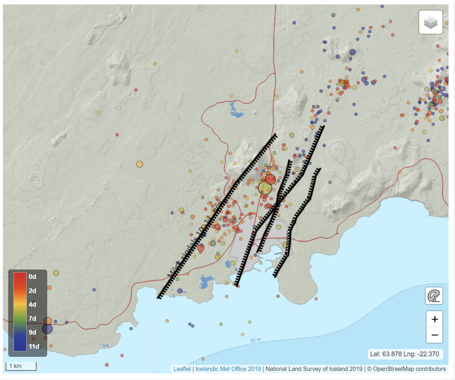 The map shows seismicity detected from 3 March to 14 March. Black lines outline Grabens that formed in diking events on 10 November 2023 and 14 January 2024. (Click map to enlarge)
- CreatedFriday, March 15, 2024
- Last modifiedSaturday, March 16, 2024
World Desk Activities

cpj.org/resources-for-journalists-covering-protest…

cpj.org/2020/09/guide-to-legal-rights-in-the-u-s/

pressfreedomtracker.us/submit-incident/

drive.google.com/file/d/17XyVCVOTq59bvTEG_RZAQMgrF…

www.icfj.org/news/new-icfj-knight-fellows-work-sup…

U.S.Justice Department: "Radical Right vs. Radical Left: Terrorist Theory and Threat"
www.ojp.gov/ncjrs/virtual-library/abstracts/radica….
ijnet.org/en/story/tips-building-networks-reach-au…

trustingnews.org/how-trustworthy-is-your-newsroom-…

Latest Stories


Electronic Frontier Foundation
- Free Speech Around the World | EFFector 36.6 May 08, 2024
- What Can Go Wrong When Police Use AI to Write Reports? May 08, 2024
- Speaking Freely : Nompilo Simanje May 07, 2024
- Podcast Episode: Building a Tactile Internet May 07, 2024
The Intercept
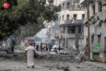
- As Biden Warns Against Rafah Invasion, AIPAC Pushes Congress to Support Israel’s Operation May 08, 2024
- Some Universities Chose Violence. Others Responded to Protests by Considering Student Demands. May 08, 2024
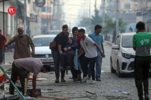
- 600,000 Palestinian Kids in Rafah Can’t “Evacuate” Safely, UNICEF Official Says May 08, 2024
- They Used to Say Arabs Can’t Have Democracy Because It’d Be Bad for Israel. Now the U.S. Can’t Have It Either. May 08, 2024
VTDigger
- Vermont Conversation: Dartmouth Professor Annelise Orleck was arrested but not silenced May 08, 2024
- Final Reading: Another side of Dick McCormack May 08, 2024
- Vermont lawmakers advance bill to increase supervision of people accused of crimes May 08, 2024
- Vermont opioid deaths decline for the first time since 2019, according to preliminary data May 08, 2024
